One of my major projects in the past few years was writing more than 60 episodes (4-5 mins. each) for a videoguide app on Central Park from Guides Who Know. For the app, I collected hundreds of images of Central Park during the 19th century. I find this year-by-year archival view fascinating, so I’m sharing it by uploading a half dozen or so images per week. See this page for links to all the pages of images.
To be notified when new images appear, follow me on Twitter @NYsculpture.
For blog posts on specific aspects of Central Park, click on Central Park in the Obsessions cloud at lower right. For an overview of the early years of the Park, see Central Park: The Early Years, which includes some of the images on these pages.
1861
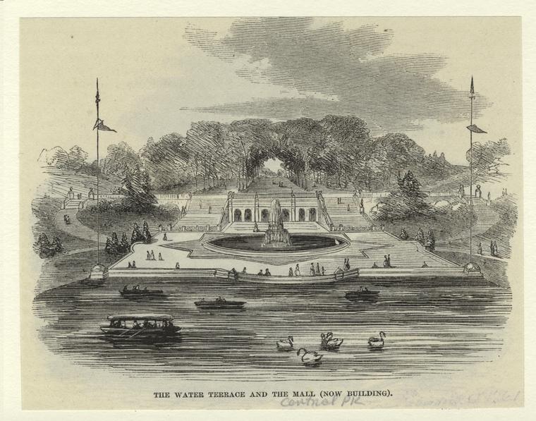
Bethesda Terrace, with the pre-Angel of the Waters fountain. NOTE: The NYC archives has some detailed drawings by Jacob Wrey Mould for elements of the Terrace such as the bases of the flagpoles. Posting those images here would require a payment, so I won’t; but if you’re a serious historian of the Park, you ought to check them out.
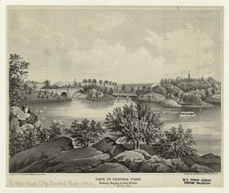
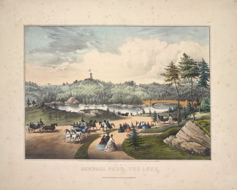
View of the Lake with the Balcony Bridge and Oak Bridge. The fire tower (where the Belvedere now stands) is toward the right. The trees in the Ramble are so much less dense!
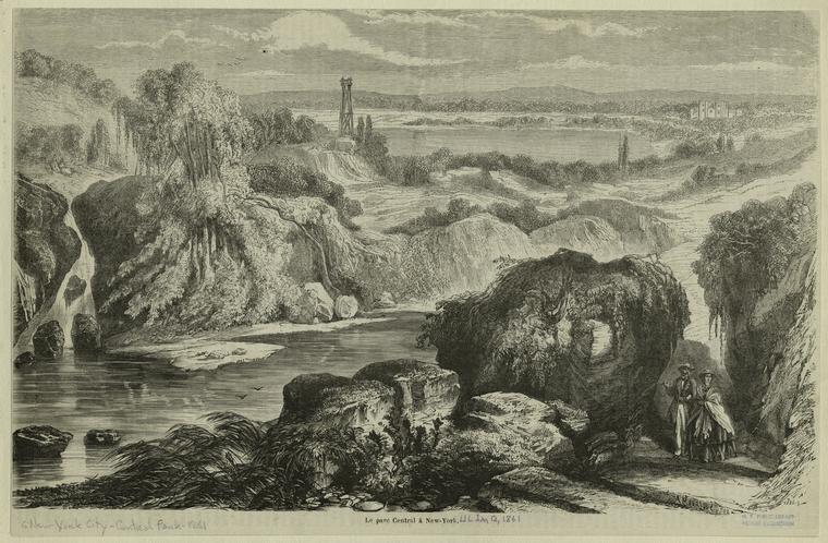
The Lake and the fire tower. I think that’s the Arsenal at the far right.
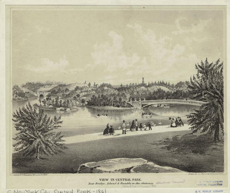
The Bow Bridge, with the fire tower in the distance behind it.
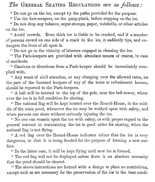
In Central Park’s early years, skating on the Lake was a major attraction. The regulations are … fascinating.
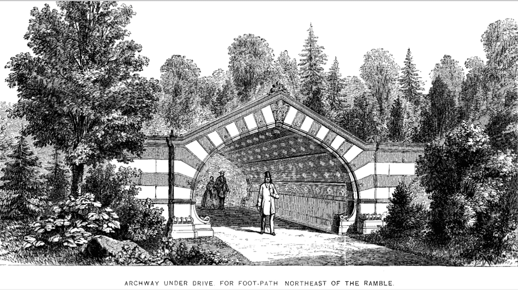
The Greywacke Arch is just west of where the Metropolitan Museum now stands.
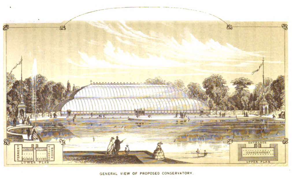
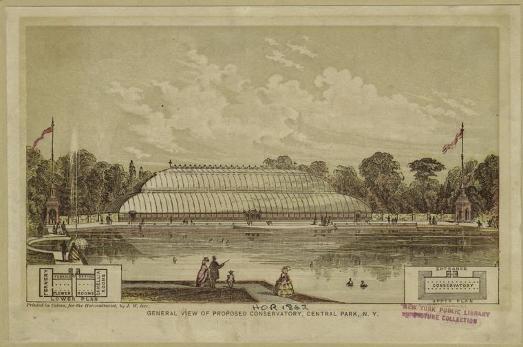
Plan for a proposed conservatory, which never rose above its foundations, but gave its name to Conservatory Water near 72nd Street. (Didn’t you ever wonder why that pond had that name?)
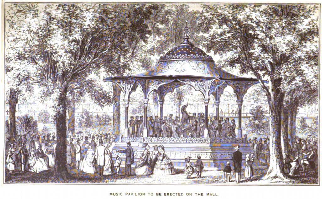
Proposed wooden music pavilion designed by Jacob Wrey Mould. Erected in 1862, it stood near where the Naumburg Bandshell is today. More pics in later sections. The last image I could find of it was ca. 1916: it seems to have disintegrated.
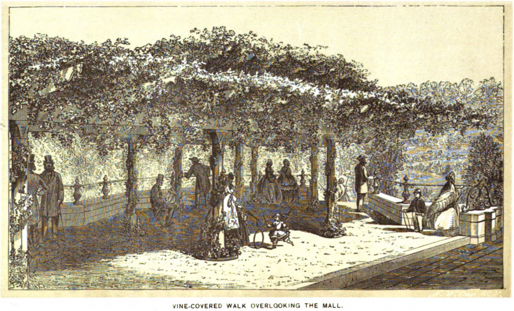
The Arbor, at the northeast end of the Mall.
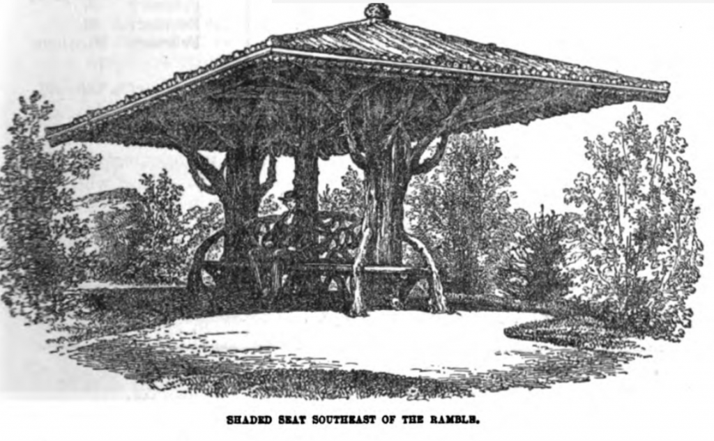
Shaded seat near the Ramble.
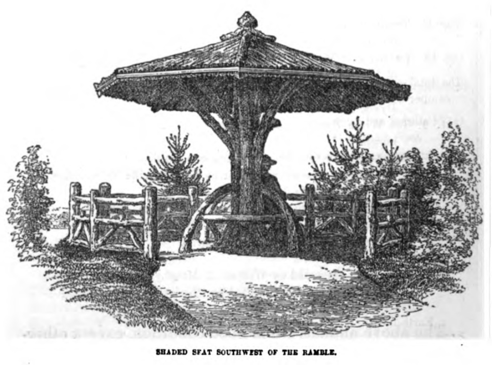
A shaded seat southwest of the Ramble.
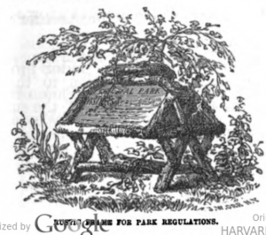
Rustic frame for Park regulations.
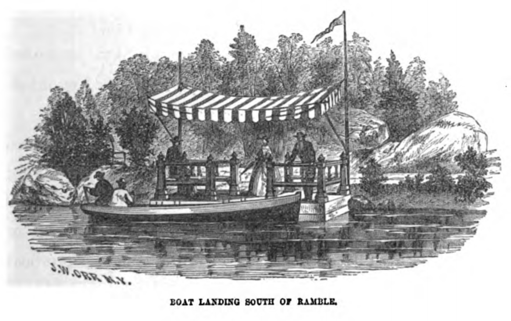
Boat landing on the Lake.
1861: Infrastructure
These are from the annual report of the Board of Commissioners (their fifth), reporting on 1861, published 1862.
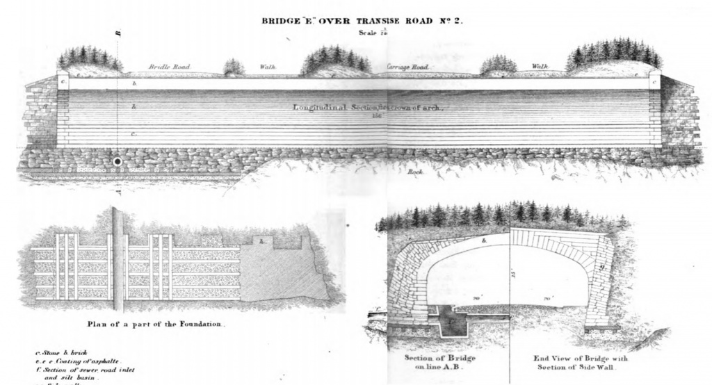
Transverse Road 2 is at 79th Street. Bridges over the transverses do not have cool names: this one is just “Bridge E”.
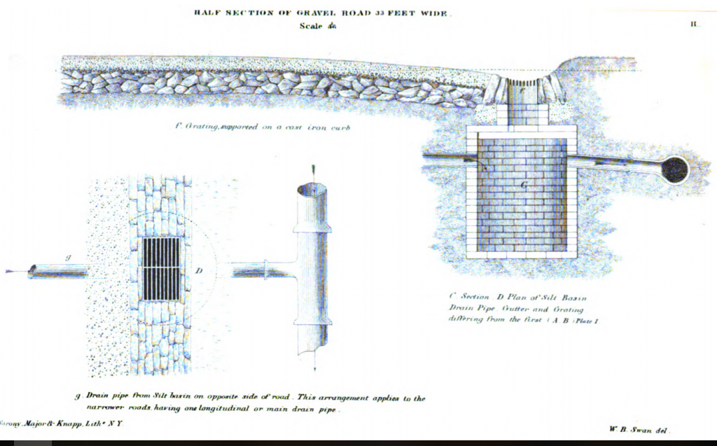
Cross-section of a gravel road.
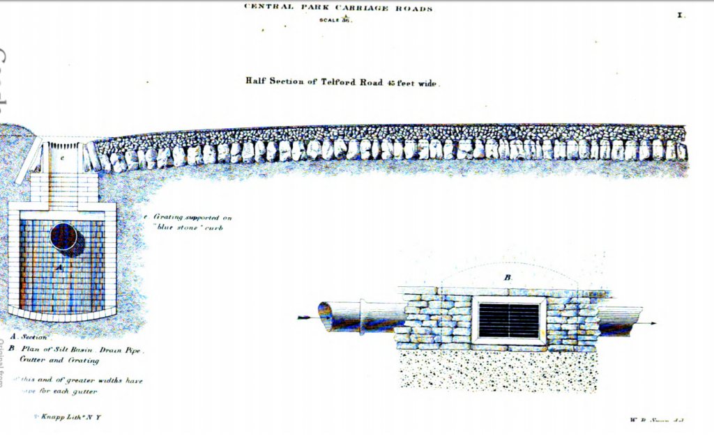
Structure of the carriage roads.
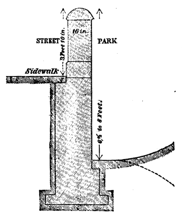
Sketch for part of the wall around Central Park. For more on the walls and gates, search those terms below, and see the three posts beginning here on the naming of the gates.
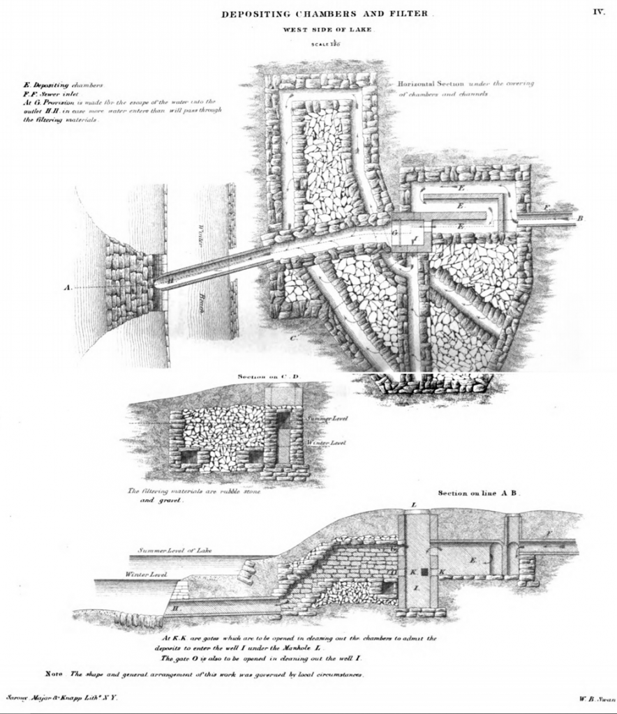
Part of the mechanism for keeping the Lake clean.
1862: north end of the Park
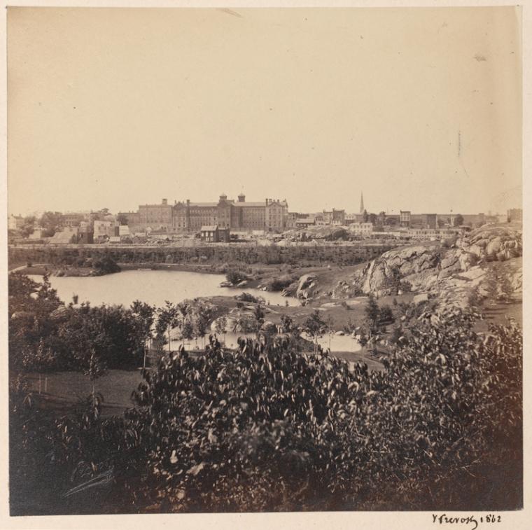
St. Luke’s Hospital at 113th and Amsterdam, photographed by Victor Prevost … possibly from inside Central Park, although it doesn’t seem quite far enough away.
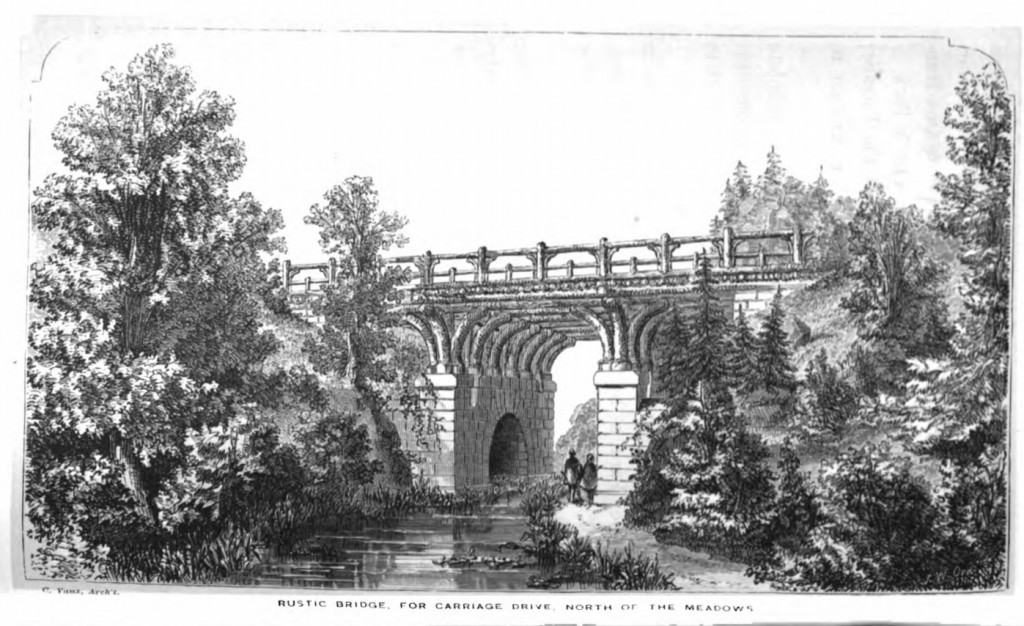
Glen Span takes the West Drive over a pedestrian pathway at about 102nd Street, east of the Pool and west of the Loch. According to the Central Park Conservancy’s site, the bridge was constructed in 1865; twenty years later, for maintenance reasons, the wooden sections were replaced with stone, making it look quite different today (image here).
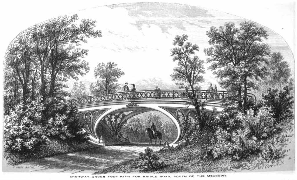
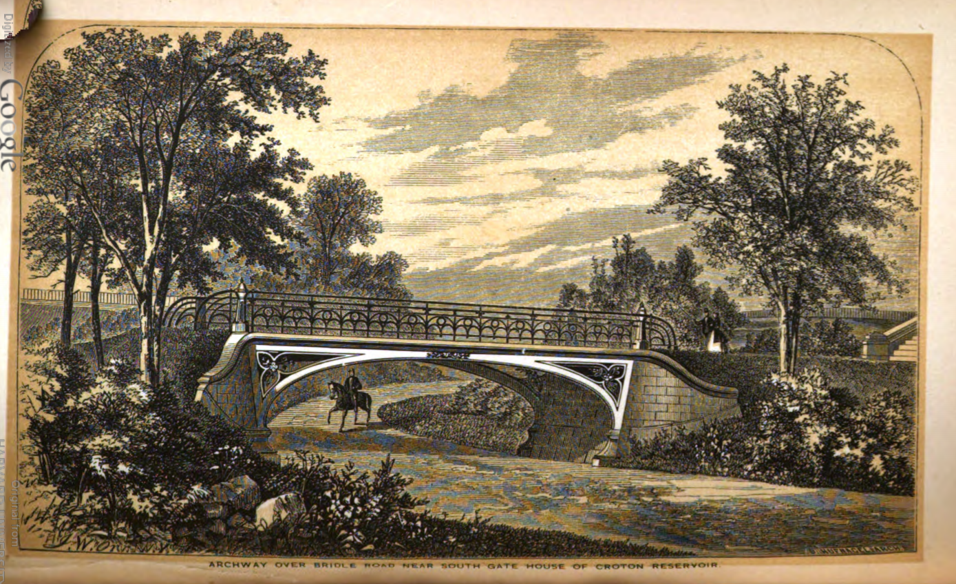
Cast-iron bridge by the new Reservoir to carry pedestrians over the bridle path. It’s known as “Bridge No. 28” or the “Gothic Bridge, for the pointed arches used in its design.
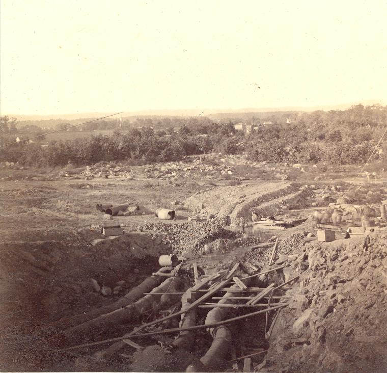
1862: Construction of the new reservoir
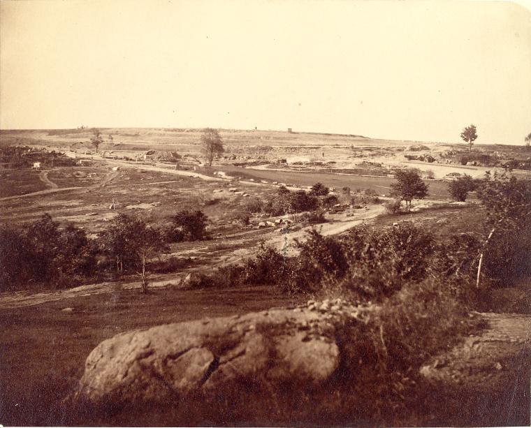
1862: in the Ramble
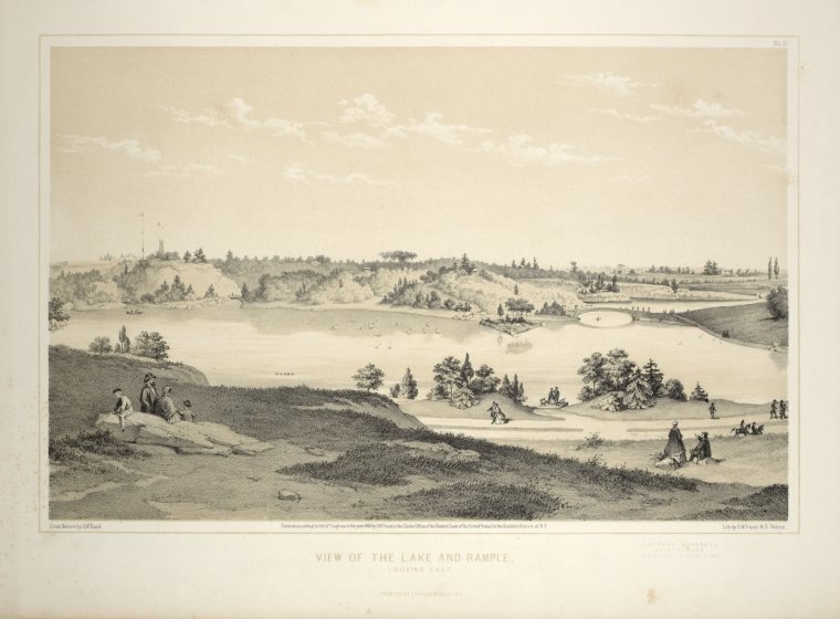
The Ramble, with Bethesda Terrace and the Mall in the center distance. Now that the trees have had 150 years to grow, this view is no longer possible.
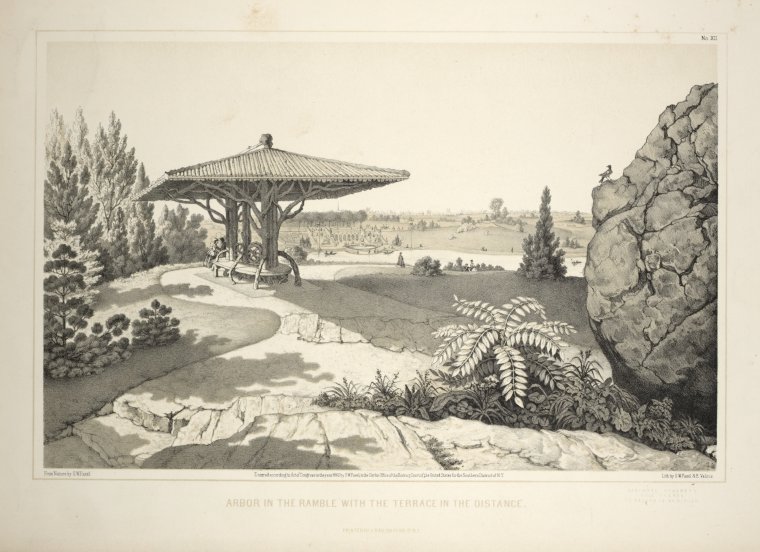
The Ramble from the distance, with the rustic shelter above crowning the hill, the fire tower (where the Belvedere now stands) toward the left, and Bow Bridge toward the right.
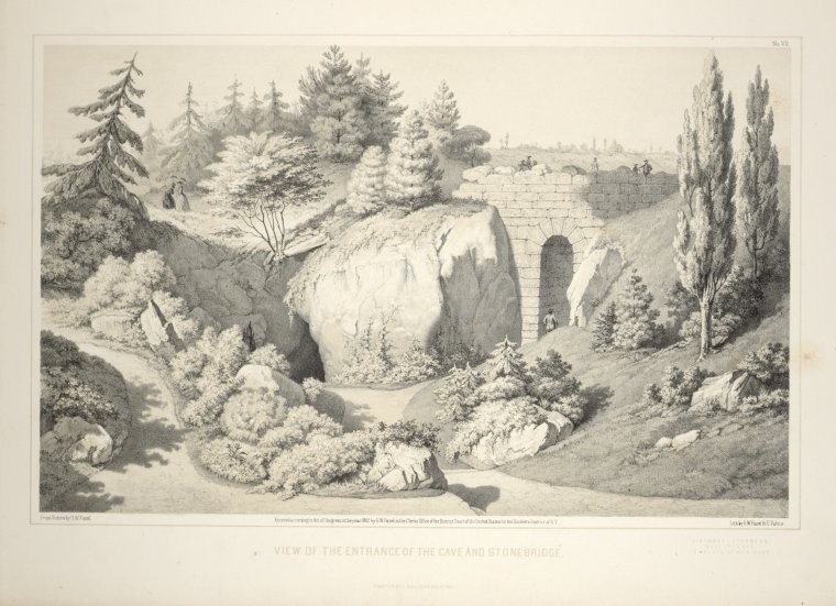
In the Ramble: the mouth of the cave near the Rustic Arch. The cave was closed to visitors long ago.
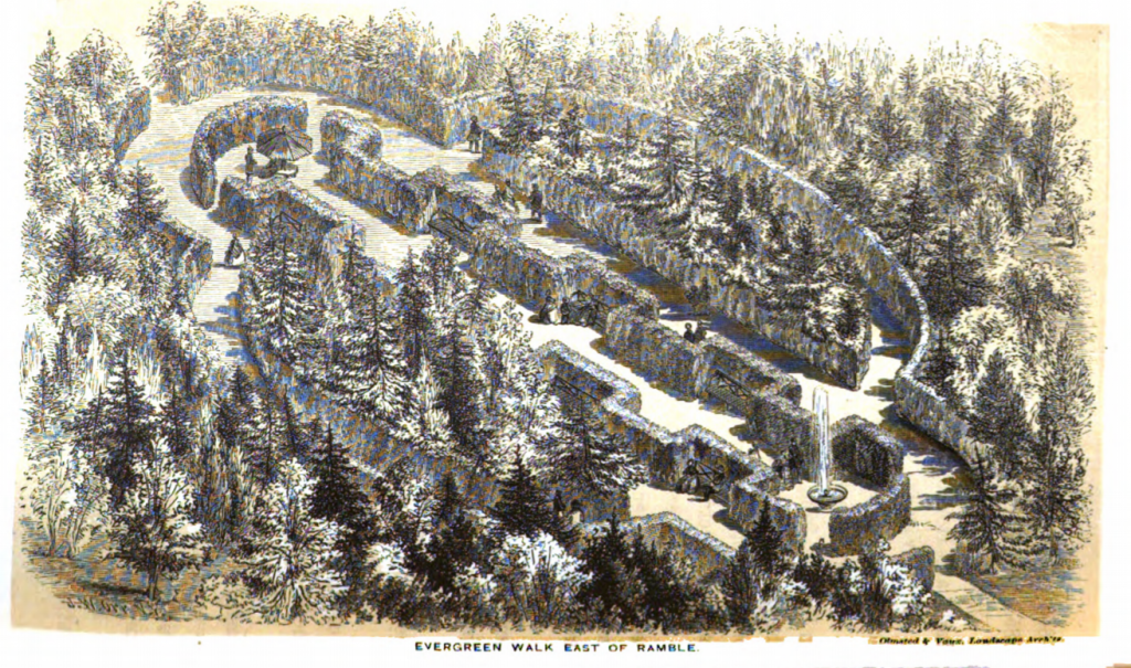
I can’t remember if this Evergreen Walk was actually built or not: sometimes the Board of Commissioners’ annual reports show projects planned rather than finished. “East of the Ramble” could mean anywhere between 72nd and 79th Streets, between Fifth Avenue and the East Drive.
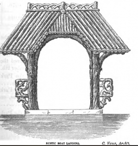
Rustic boat landing on the Lake.
A more factual image of the Ramble in 1862, by Prevost.
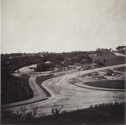
1862: Southern end of the Park
View of the firetower, Ramble, Lake, and Bow Bridge.
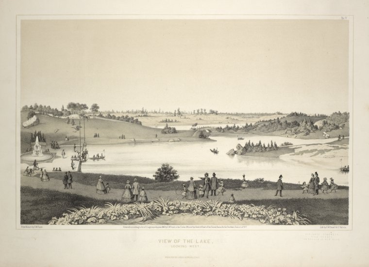
View of the Lake looking west, with Bethesda Terrace on the left.
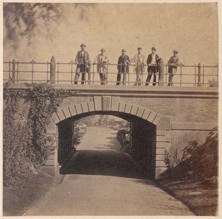
The men most responsible for Central Park, captured by French photographer Victor Prevost.
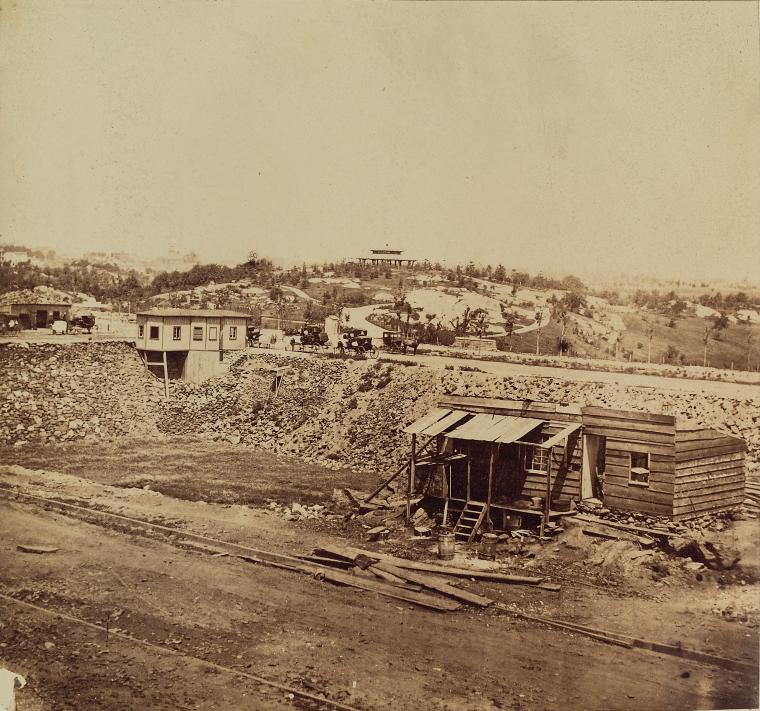
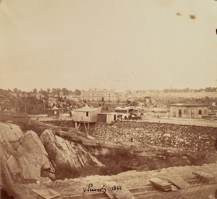
Construction in the Park: two views by Victor Prevost.
Proposed conservatory, intended to stand on the present site of Conservatory Water, just north of 72nd Street on the east side of the Park.
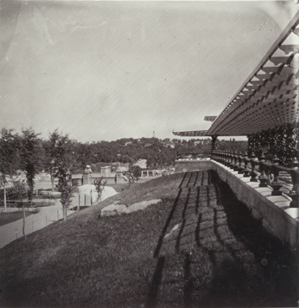
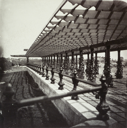
The Arbor near the north end of the Mall, in two photos by Victor Prevost, 1862.
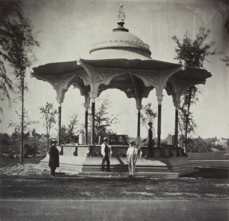
Jacob Wrey Mould’s elegant (and long gone) Music Pavilion, at the north end of the Mall. Search this page for “pavilion” to see the Prang chromolithograph that gives an idea of its brilliant colors.
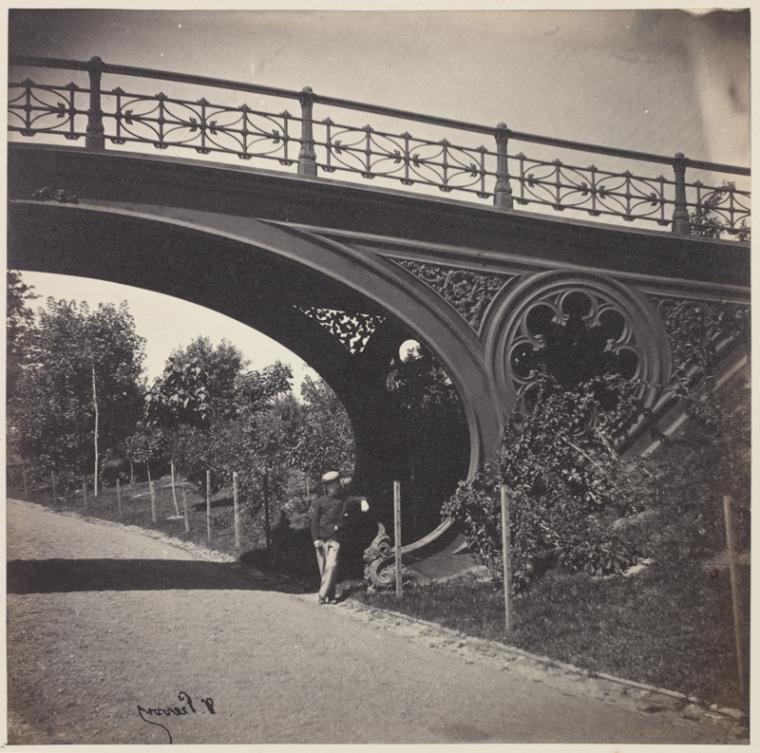
Pine Bank Arch (carrying pedestrians over the bridle path in the southwestern corner of the Park) in two photos by Victor Prevost, 1862.
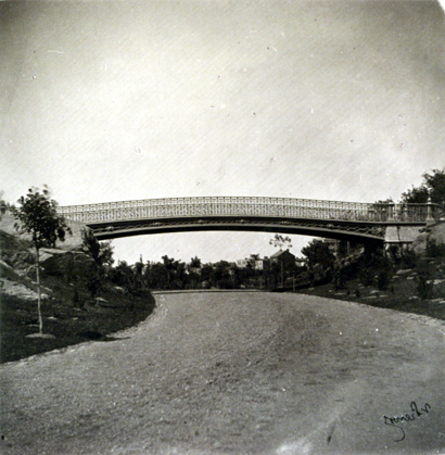
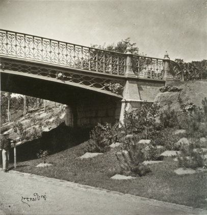
Spur Rock Arch, one of the bridges destroyed by Robert Moses in the 20th century.
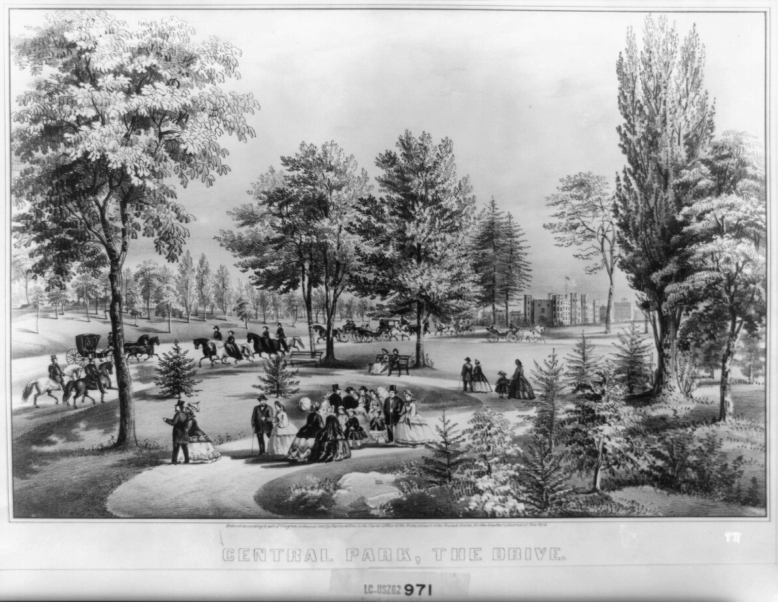
The Central Park Drive, with the Arsenal in the background.
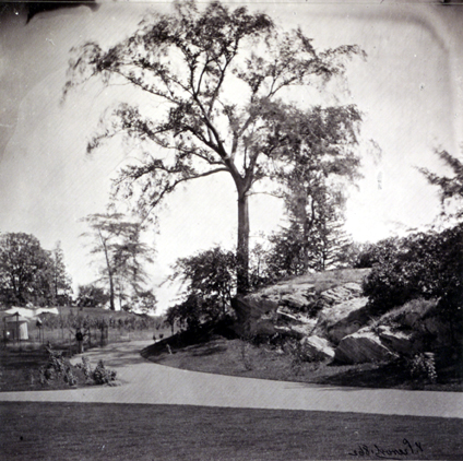
Not sure where this one was taken, or why Victor Prevost thought it was worth taking.
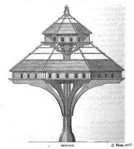
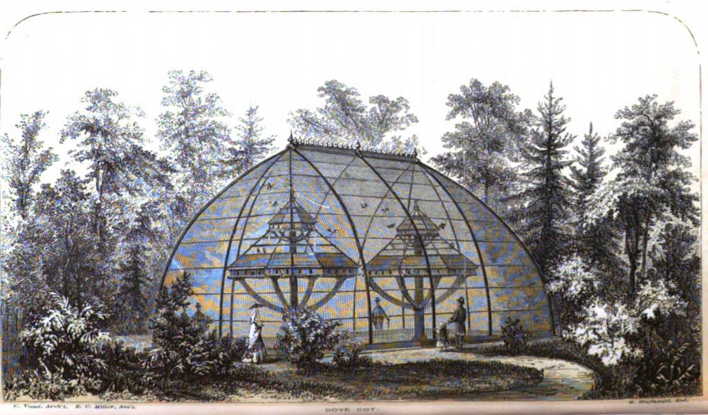
I assume these dove-cots were in the southern part of the Park.
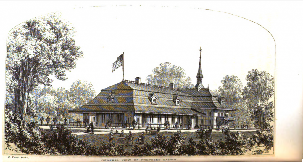
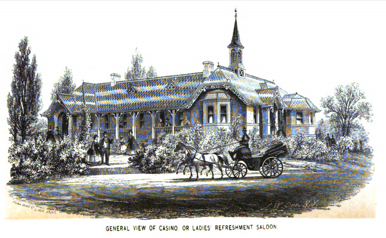
Sketch of Calvert Vaux’s proposed Casino, a restaurant for ladies northeast of the Mall, where the SummerStage now stands. See my post on Vaux.
1862 Bethesda Terrace
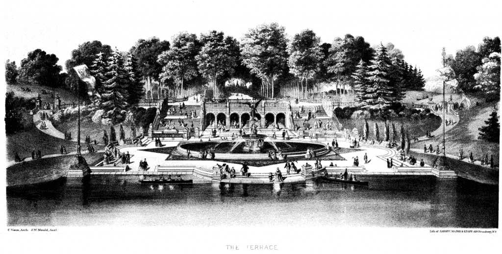
Sketch of Bethesda Terrace: wishful thinking from the Board of Commissioners of Central Park.
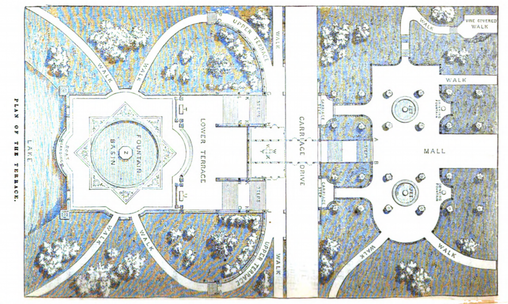
Plan of Bethesda Terrace and the north end of the Mall. North is to the left.
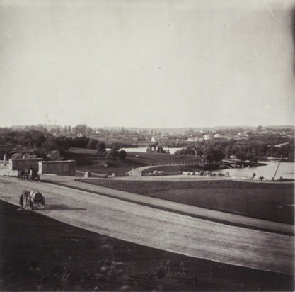
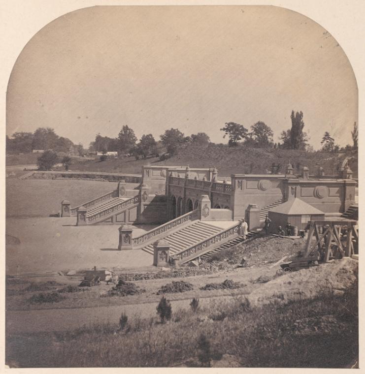
Construction of Bethesda Terrace, in a photo taken in 1862 by French photographer Victor Prevost.
Prevost’s photo of the construction of Bethesda Terrace.
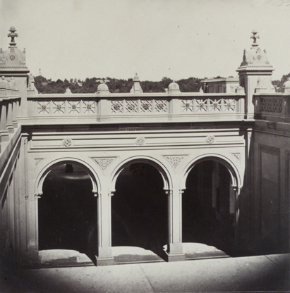
Arches of Bethesda Terrace in a photograph by Victor Prevost, 1862.
The figure by the pillar of Bethesda Terrace is either Jacob Wrey Mould or photographer Victor Prevost.
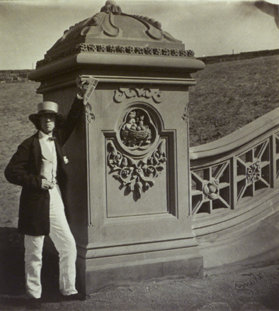
And again: The figure by the pillar of Bethesda Terrace is either Jacob Wrey Mould or French photographer Victor Prevost.
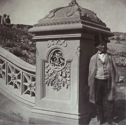
Prevost seems to have been fascinated by the pillars on Bethesda Terrace: he took several photos.
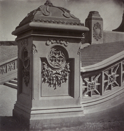
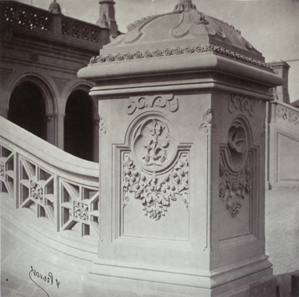
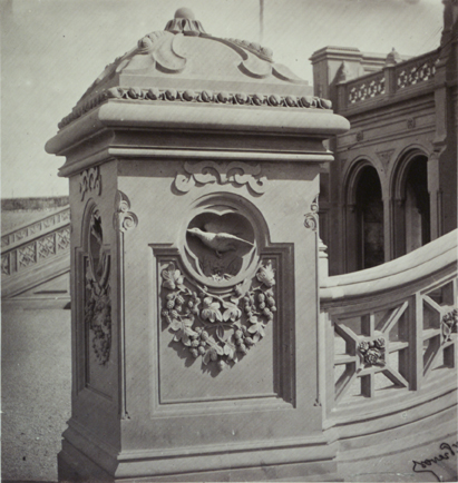
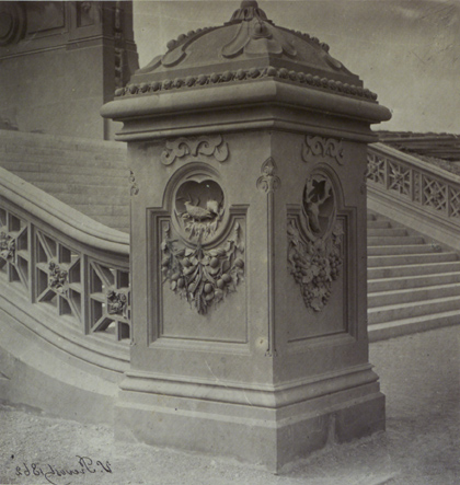
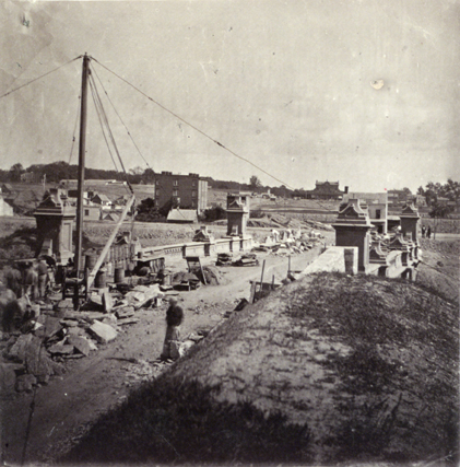
Below: Bridge under construction, in a photo by Victor Prevost, 1862. I am sorely perplexed about which bridge this is: from the pillars, it looks like part of Bethesda Terrace … but not quite.
1862: The Arsenal
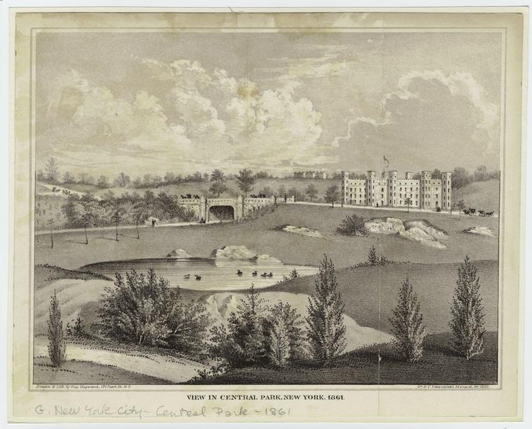
Here’s the Arsenal in an 1862 artist’s rendition.
And here it is in a photo of the same year by Victor Prevost, from a similarly tidy angle.
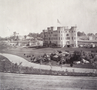
And here it is in a photo by Victor Prevost, from a not-so-tidy angle.
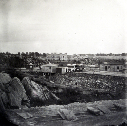
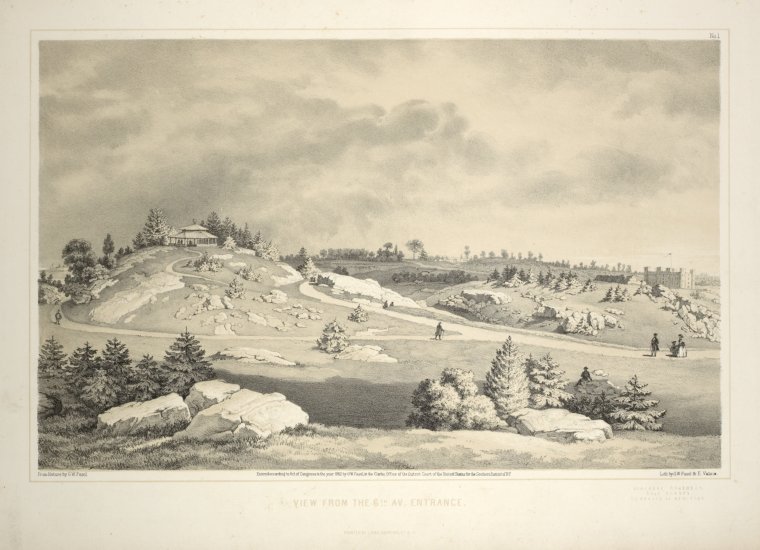
The large rustic summerhouse in the southwestern end of the Park.
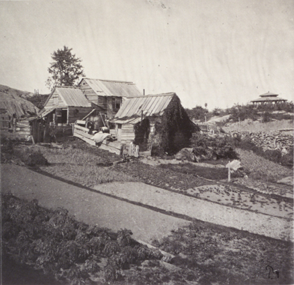
The same summer house in photos by French photographer Victor Prevost.
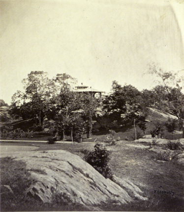
Is this what they call a RAW image? Another Prevost photo of the summer house.
1862: Central Park and the Civil War
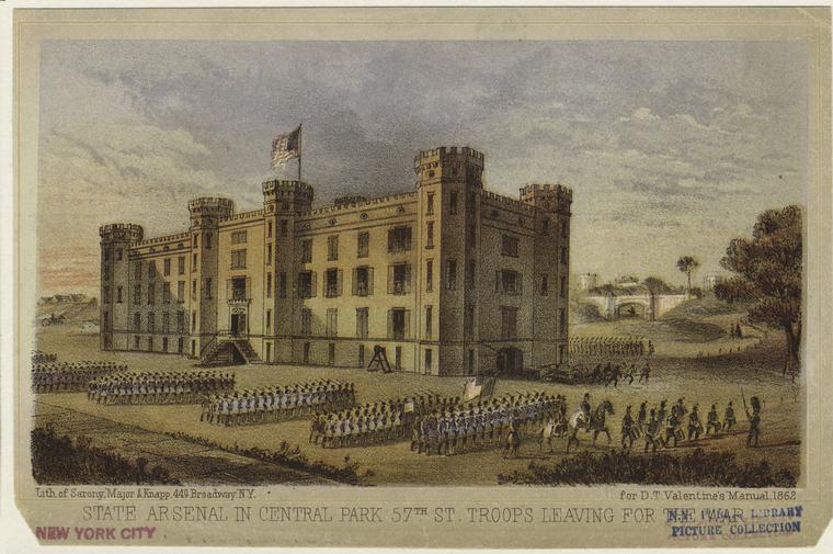
Union soldiers drilling in front of the Arsenal, before being sent off to the front line. For more on the Arsenal’s history, see this post.
1863
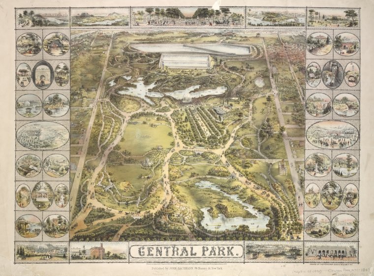
Bird’s-eye view of Central Park, 1863. The resolution unfortunately isn’t high enough to identify all the vignettes around the edges.
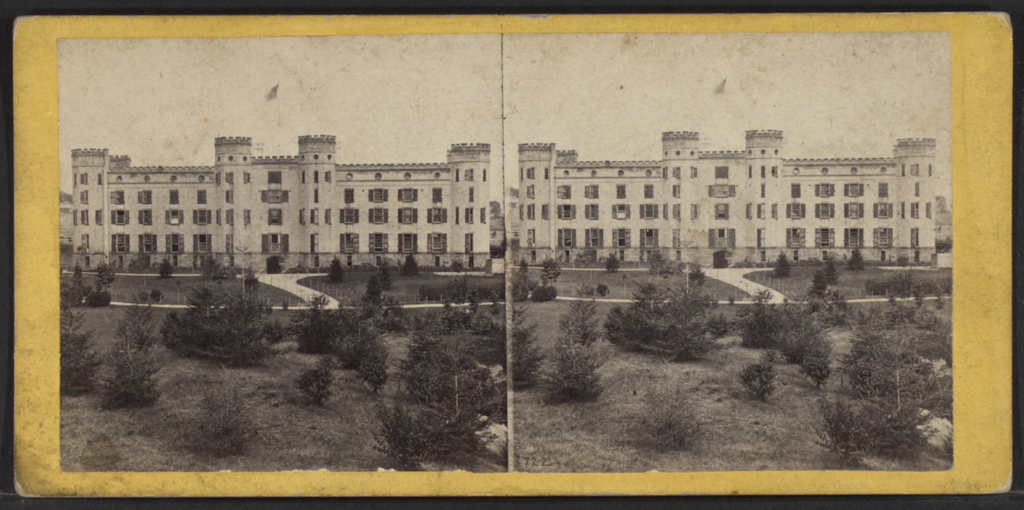
The west side of the Arsenal, ca. 1863-1865. This large open area is now occupied by the zoo.
1863: Infrastructure
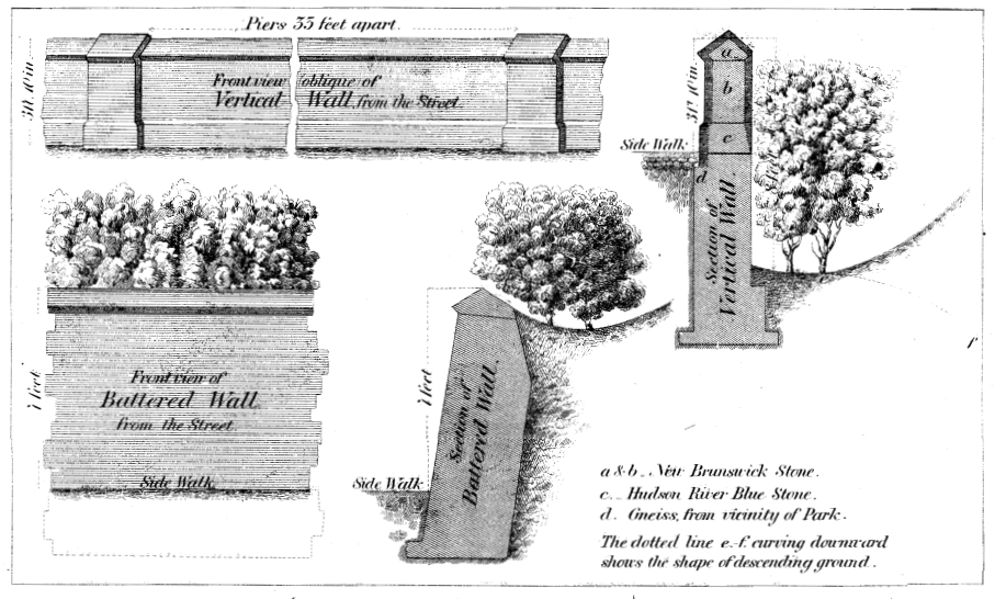
The walls around Central Park and the gates to allow entry were a subject of much debate. On the names finally chosen, see the three posts starting here.
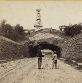
During the early years of the Park, a fire tower stood where Belvedere Castle was later built. Here it is looming over the tunnel in the 79th Street Transverse.
1863: Bridges
The Southeast Reservoir Bridge carries pedestrians over the bridle path south of the Reservoir and just west of Fifth Avenue, near 86th Street.
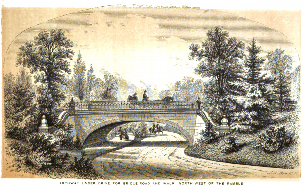
The Winterdale Arch carries the West Drive over the bridle path at about 82nd Street.
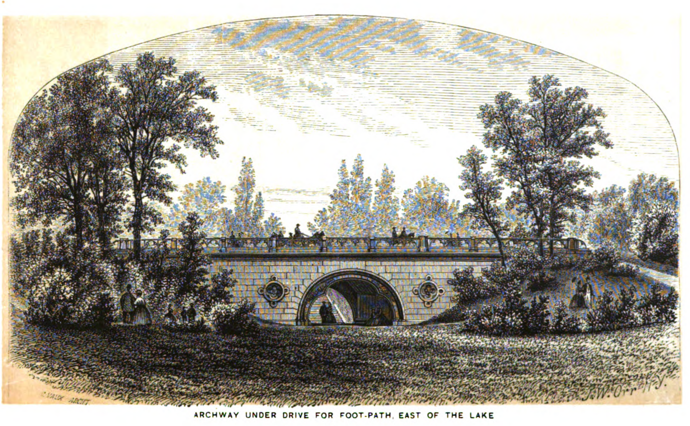
Trefoil Arch takes pedestrians under the East Drive near the Boathouse.
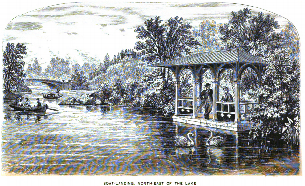
Boat landing on the Lake, with the Bow Bridge in the background.
1863: Buildings
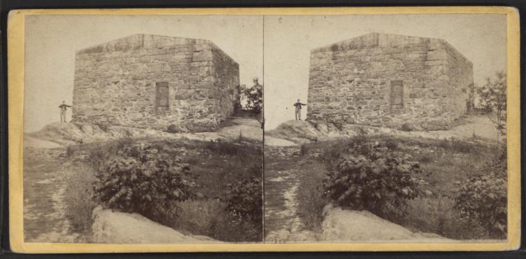
The Blockhouse, ca. 1863-1864. It looks like it has a roof!
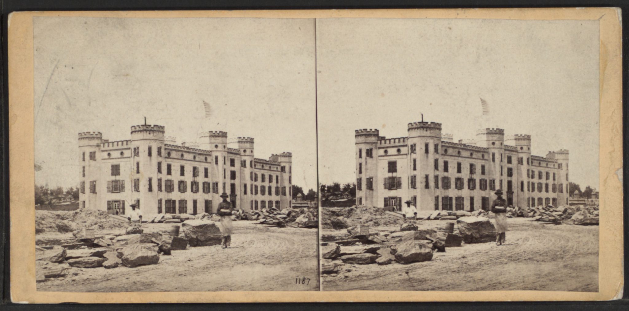
The Arsenal, ca. 1863-1864.
The Board of Commissioners’ report for 1864 (published in 1865) reported that the Casino opened in early 1864; so this illustration from the 1863 report is either work in progress or still wishful thinking.
1863: Sculpture and ornament
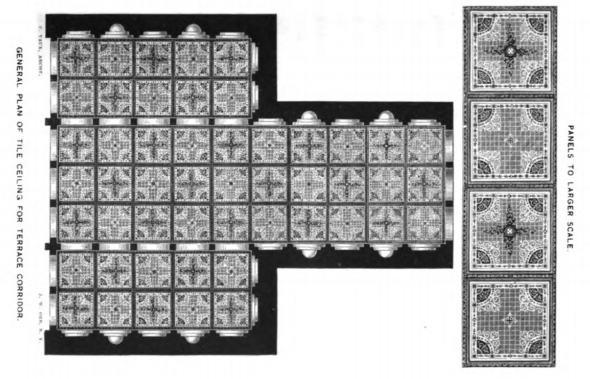
Tile ornament for the ceiling of the tunnel leading to Bethesda Terrace.
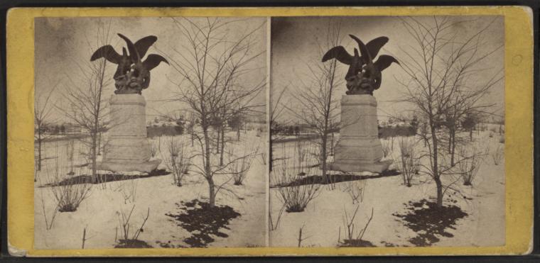
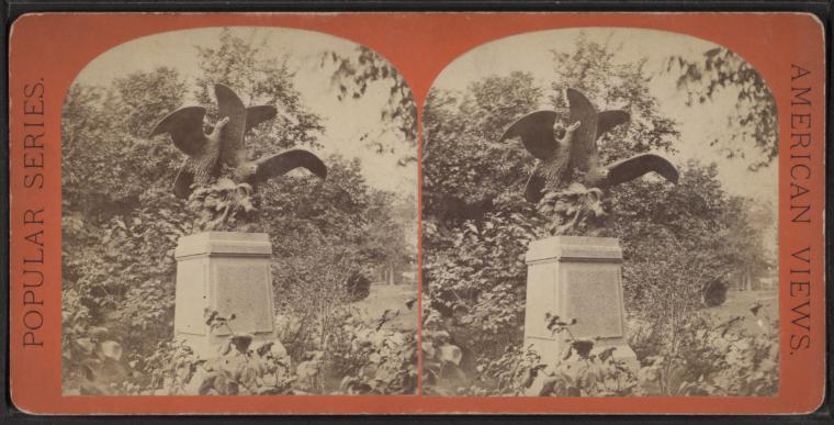
Eagles and Prey, by Christophe Fratin, was created in 1850 and donated to Central Park in 1863. The Commissioners, who were having problems with roving goats eating the plantings, probably found the sculpture grimly amusing: see this post. It still stands just west of the Mall.
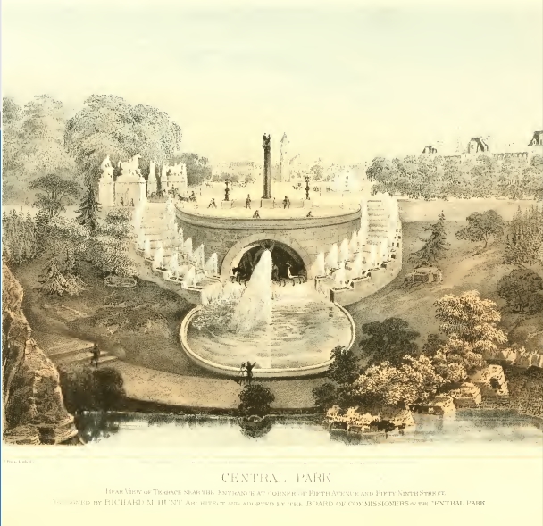
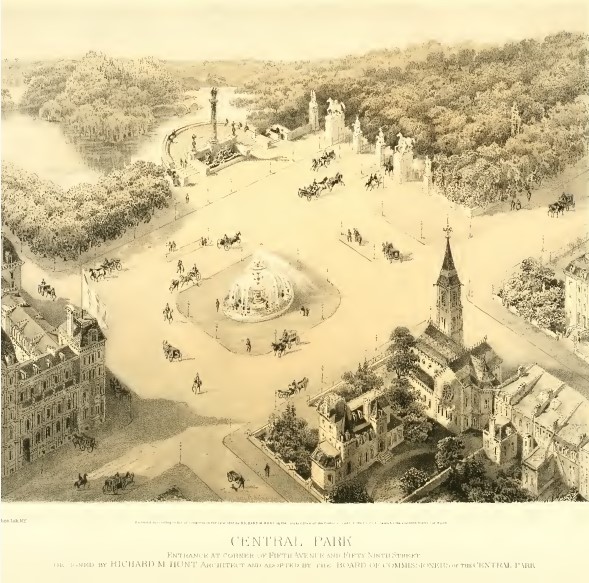
1863-1866: Richard Morris Hunt’s elaborate gates for the south end of the Park
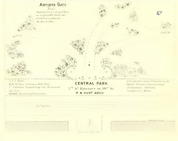
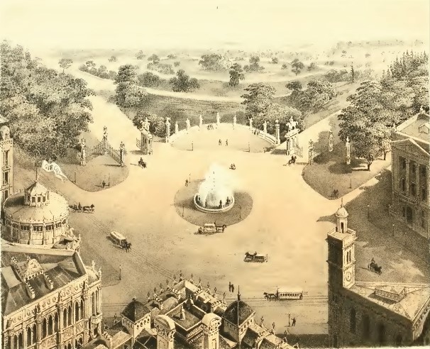
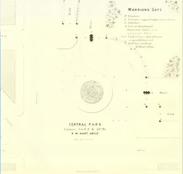
These drawings date to 1863. Hunt’s proposal was no longer in consideration by ca. 1866. These look so unlike the entrances that were actually built that it’s difficult to tell which is which.
Hunt made several sketches for the entrance at Fifth Avenue and 59th Street, the principal entrance to the Park.
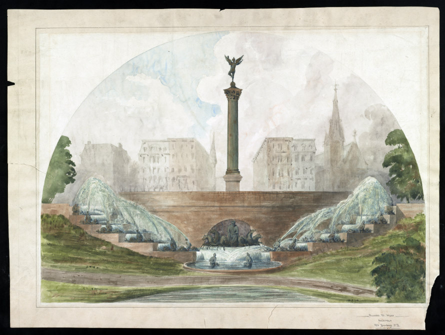
These two are noted as being for the Artists’ Gate at 59th Street and Seventh Avenue.
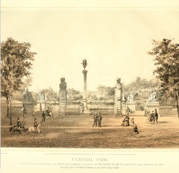
And these seem to be for 59th Street at Eighth Avenue. It’s described as the Warriors’ Gate, but that gate is now the Merchants’ Gate, and the Warriors’ Gate is on Central Park North.
1864: South end of the Park
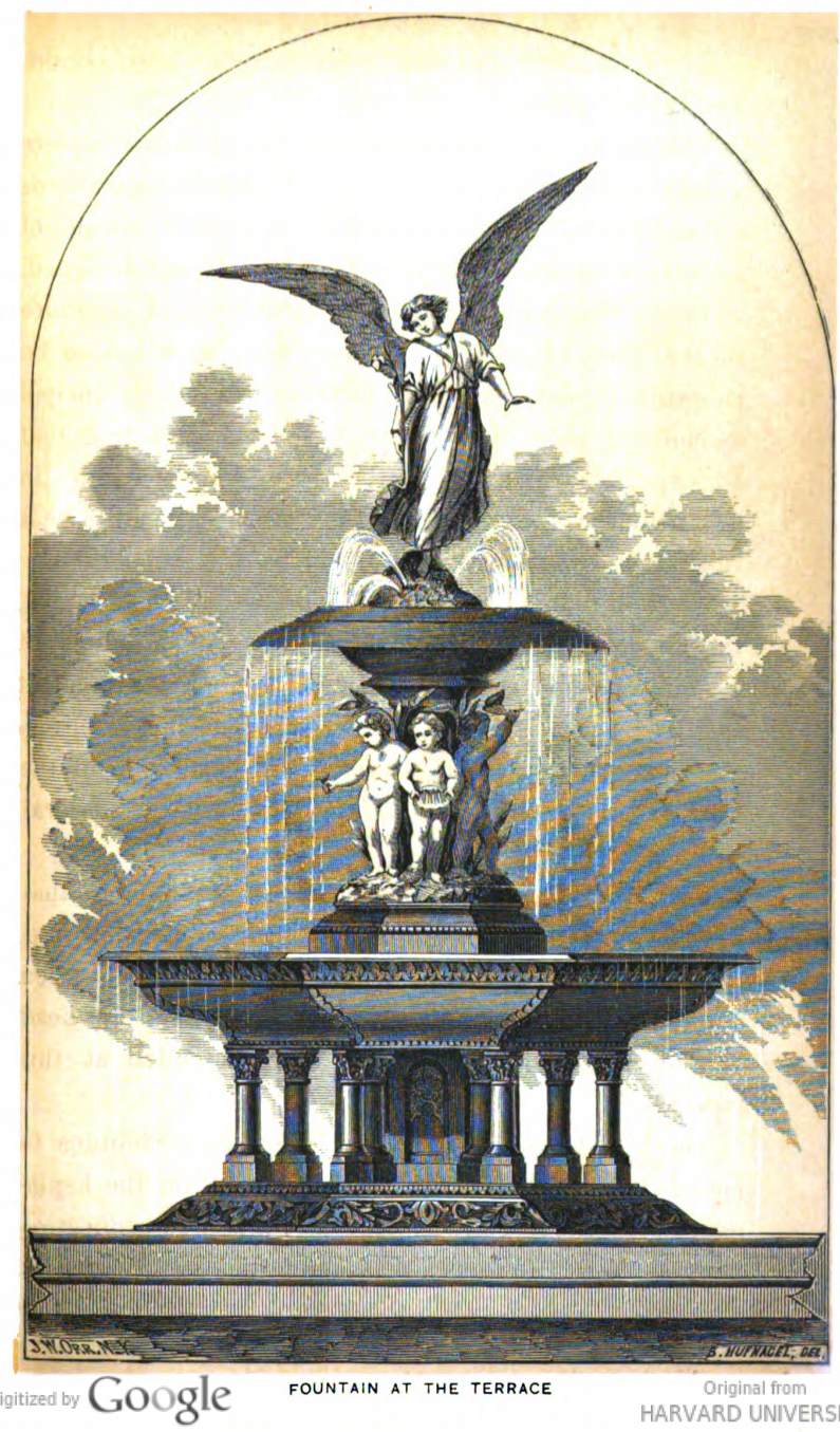
Concept for the Bethesda Fountain. It wasn’t dedicated until 1873, although the sculpture was completed a few years earlier.
From an early guidebook: Perkins, The Central Park, 1864: gawky adolescent elm trees on the Mall, looking north toward the Arbor. The Naumburg Bandshell now blocks this view.
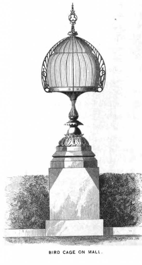
A bird cage near the Mall – given the style, probably the work of Jacob Wrey Mould.
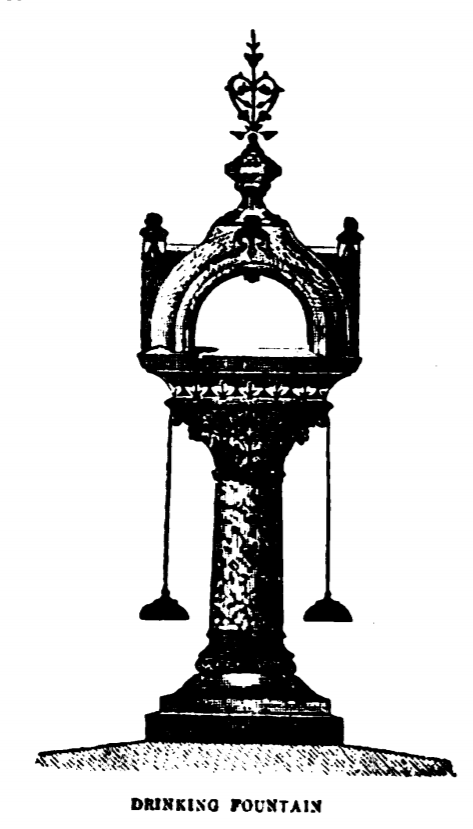
Drinking fountain – probably also Jacob Wrey Mould’s work.
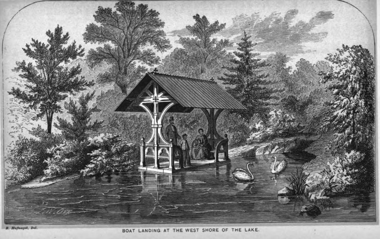
1864: Lake and Ramble
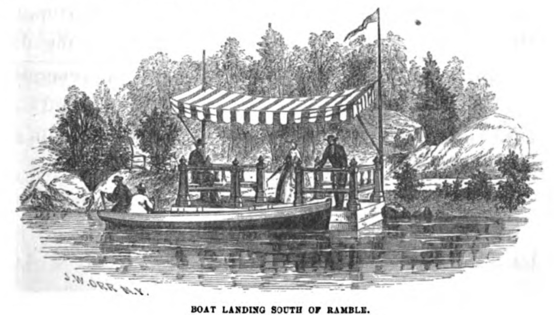
Two landings on the Lake.
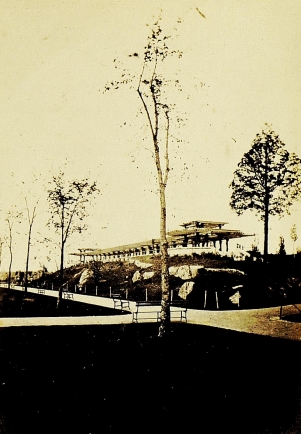
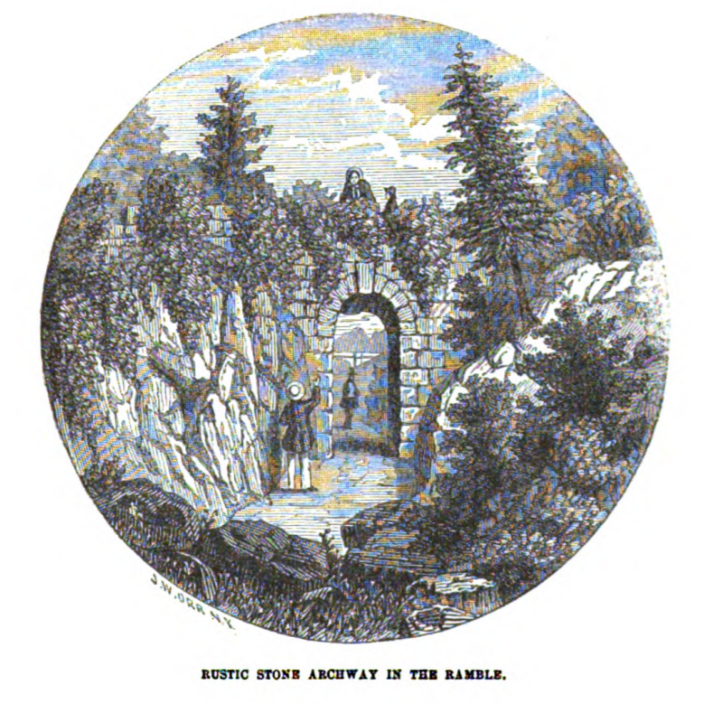
Rustic Arch in the Ramble, which carries one pedestrian path over another.
1864: Bridges
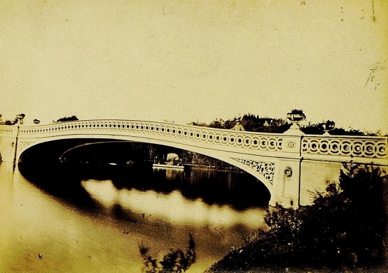
The Bow Bridge, from an early guidebook: Perkins, The Central Park, 1864.
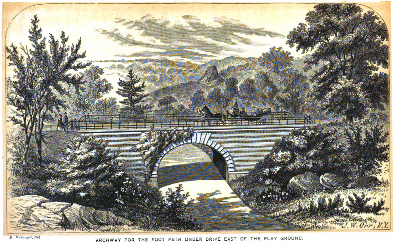
Playmates Arch, near where the Carousel now stands, carries the East Drive over a footpath.
1864: Louis Prang’s Chromolithographs
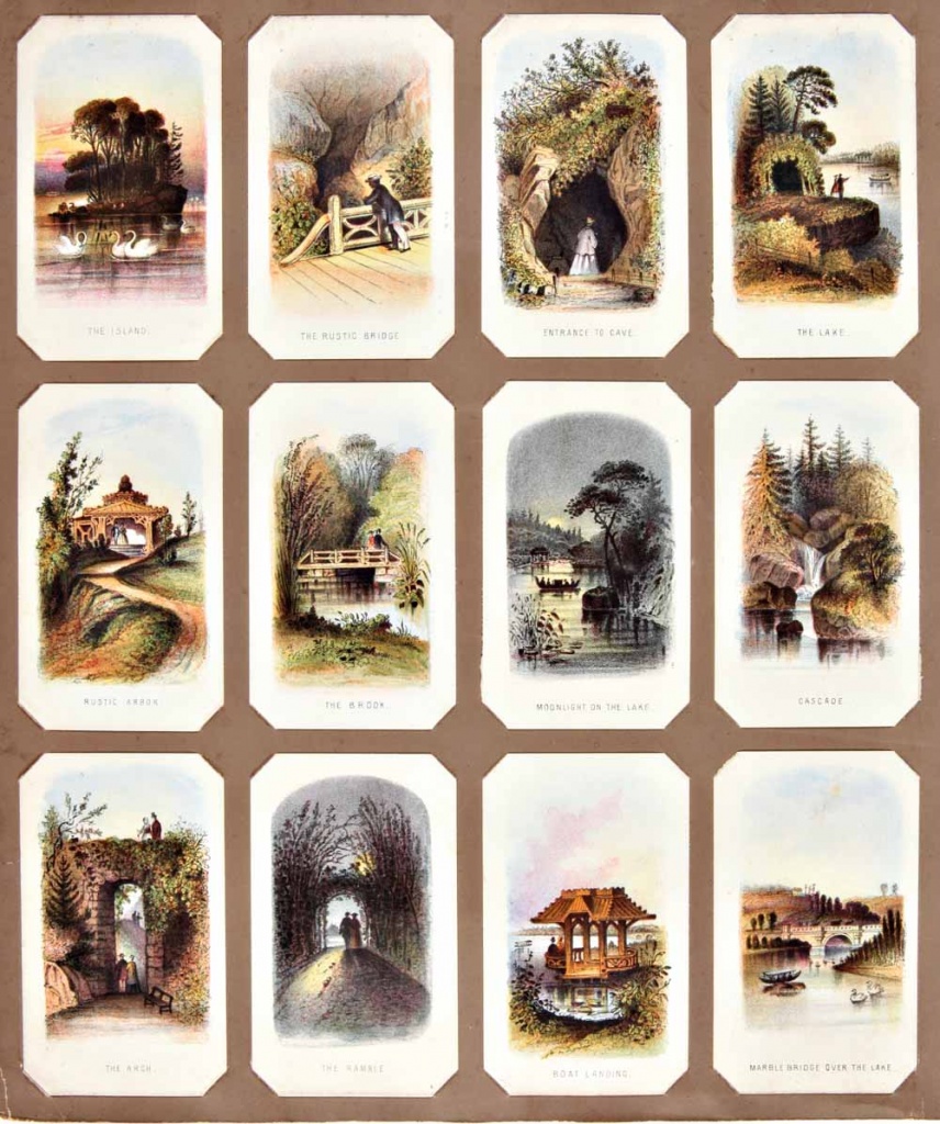
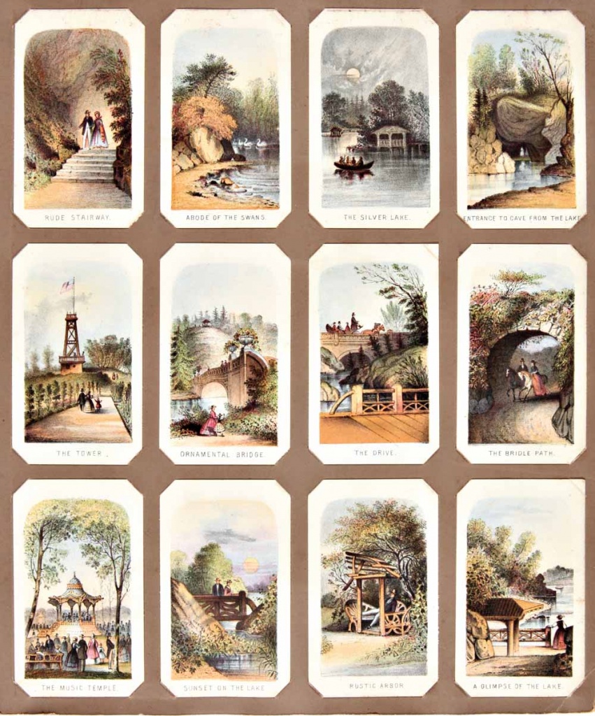
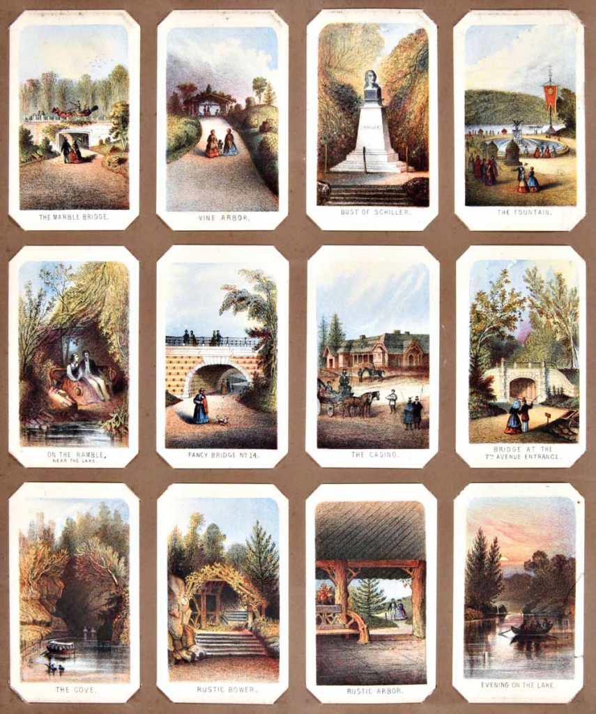
In 1864, when Central Park was six years old, Louis Prang published a set of chromolithographic cards, each 4.25 x 2.5 inches. They provide a fascinating glimpse not only at what the Park looked like at the time, but at what its highlights were considered to be. I spotted a set of these cards in a catalogue of William Reese Company a few years back; Mr. Reese was kind enough to send me photos.
Alas for you, WordPress doesn’t approve of high-res uploads. These are printed full-page at the end of my Central Park: The Early Years, and also used on the covers.
In the set below, left to right and top to bottom:
- The Island, The Rustic Bridge, Entrance to Cave, The Lake
- Rustic Arbor, The Brook, Moonlight on the Lake, Cascade
- The Arch, The Ramble, Boat Landing, Marble Bridge [sic, for Bow Bridge!] over the Lake
In the set below, left to right and top to bottom:
- Rude Stairway, Abode of the Swans, The Silver Lake, Entrance to Cave from Lake
- The Tower [the firetower, where the Belvedere now stands, seen from the edge of the original Croton Reservoir], Ornamental Bridge, The Drive, The Bridle Path
- The Music Temple [usually known as the Music Pavilion, formerly near the north end of the Mall], Sunset on the Lake, Rustic Arbor, A Glimpse of the Lake
In the set below, left to right and top to bottom:
- The Marble Bridge [i.e., Marble Arch, formerly at the south end of the Mall, now gone], Vine Arbor, Bust of Schiller, The Fountain [a figurative sculpture was always intended for Bethesda Terrace, but Angel of the Waters wasn’t dedicated until nine years after the Prang postcards were published]
- On the Ramble, near the Lake; Fancy Bridge No. 14; The Casino [formerly near the northeast end of the Mall, now gone], Bridge at the 7th Avenue Entrance
- The Cove, Rustic Bower, Rustic Arbor, Evening on the Lake
1865: Maps
The famous “Sanitary & Topographical Map of the City and Island of New York” was published in 1865 by Egbert Ludovicus Viele. The “Viele Map” shows Manhattan’s original streams, marshes and coastline, with the city grid superimposed. Those planning new buildings in the 21st century still consult the Viele Map. The blue rectangle roughly in the center is the old reservoir, at the center of Central Park. More on Viele in this post.

Map of Central Park in 1865. To zoom in, see it on the David Rumsey Map Collection site.

1865: Infrastructure and bridges
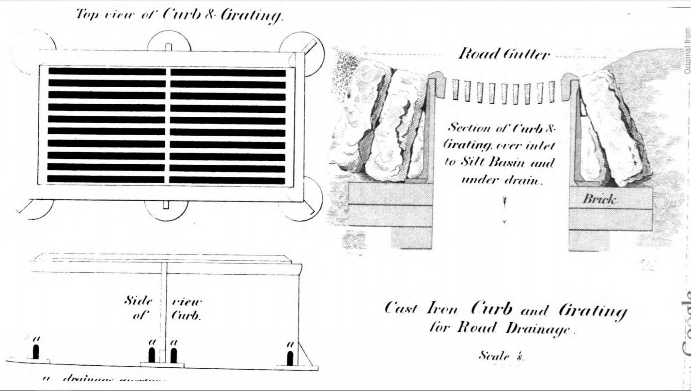
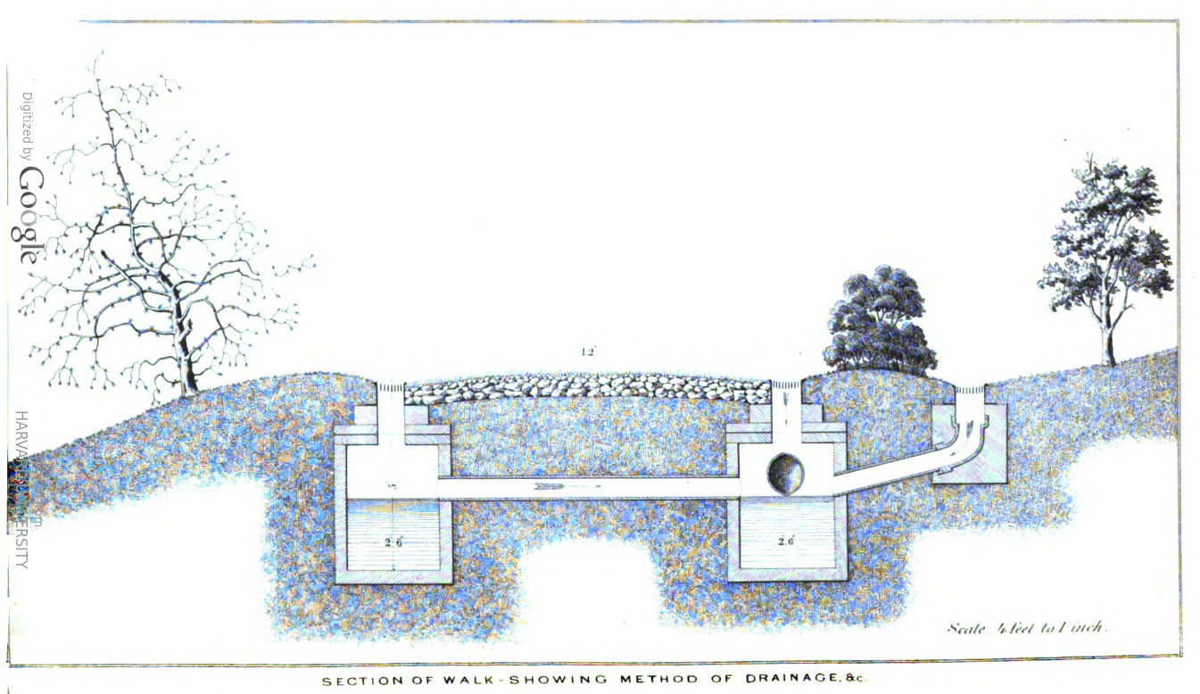
Dealing with run-off on the pedestrian walks.
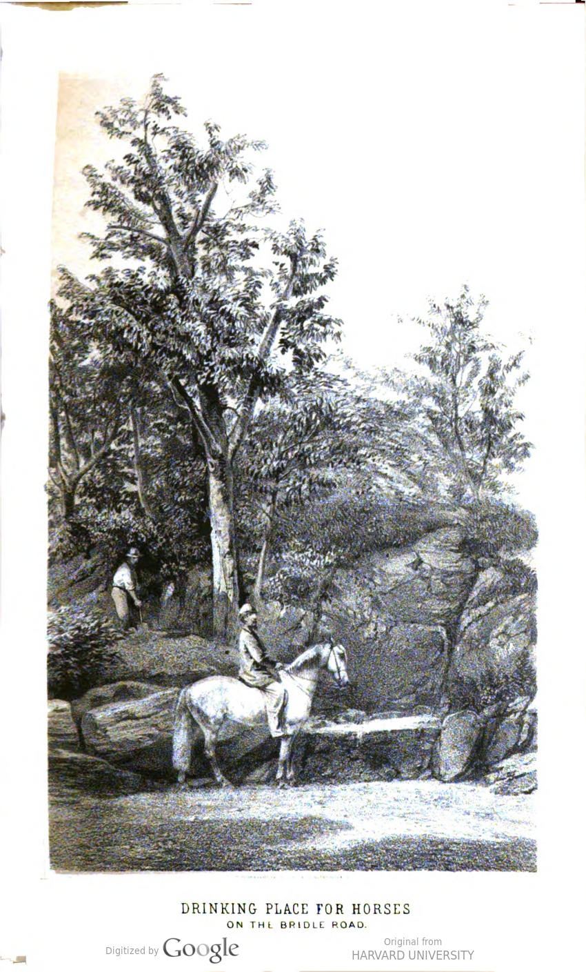
Taking care of horses: a drinking trough on the bridle path.
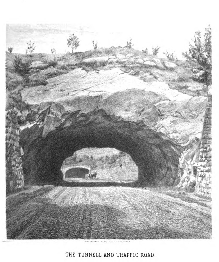
Tunnel on the 79th Street Transverse.
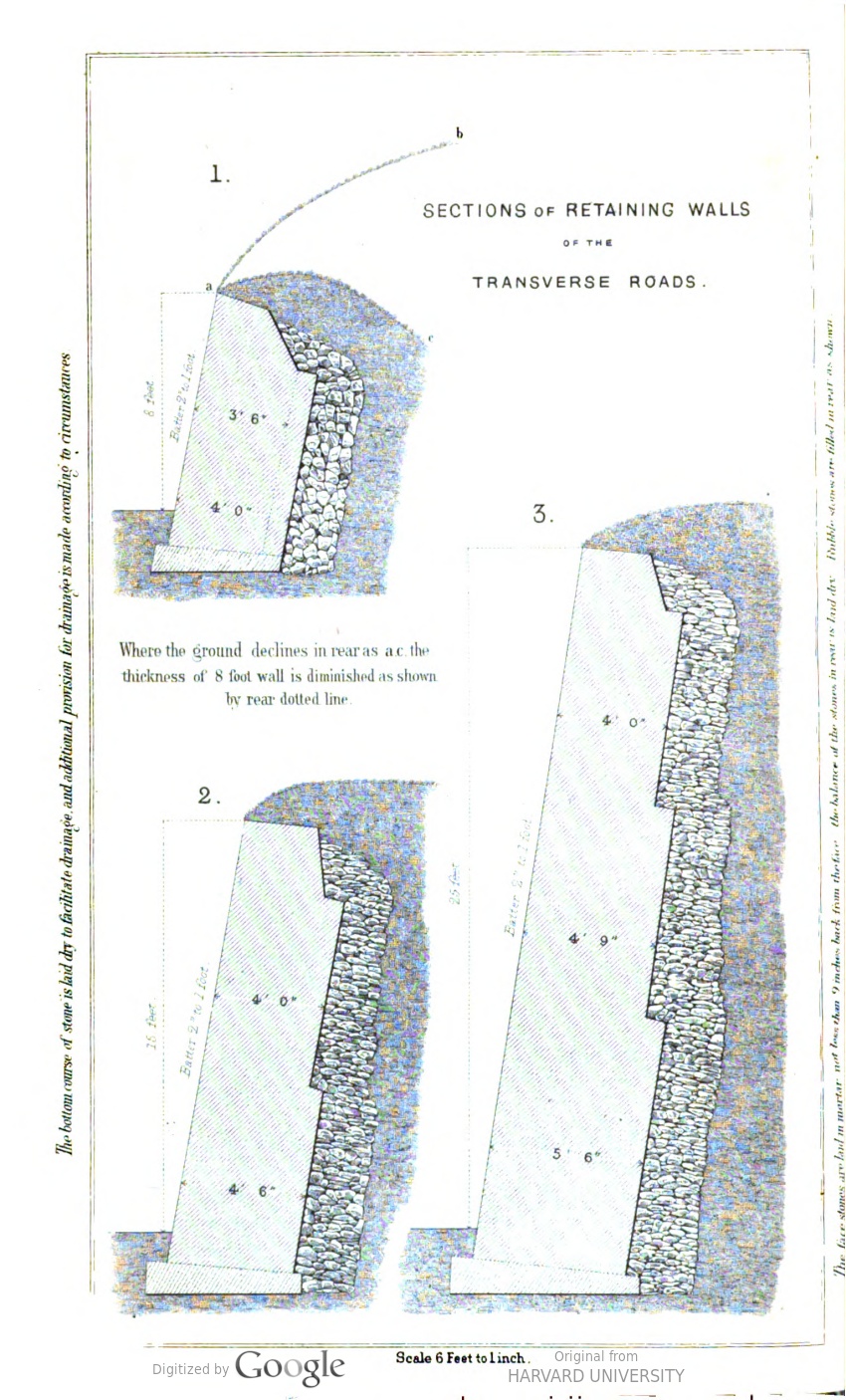
Retaining walls for the transverse roads.
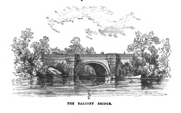
The Balcony Bridge, west of the Ramble.
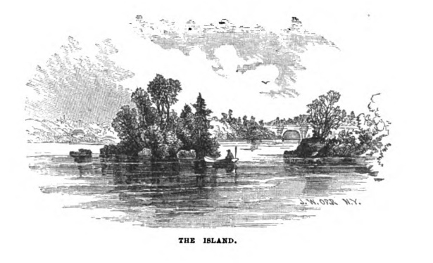
The Island in the Lake, with the Balcony Bridge in the distance.
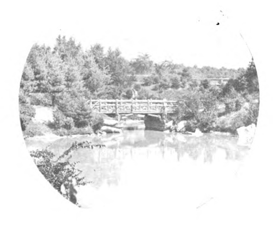
A rustic bridge in the Ramble. The Board of Commissioners’ annual report for 1865 (published 1866) was the first to include a photograph! It’s a reminder that many of the earlier images were work-in-progress or wishful thinking. Victor Prevost’s photos (see above, 1862) and some photos in early guidebooks provide a glimpse of what had actually been completed.
1865: South End of the Park
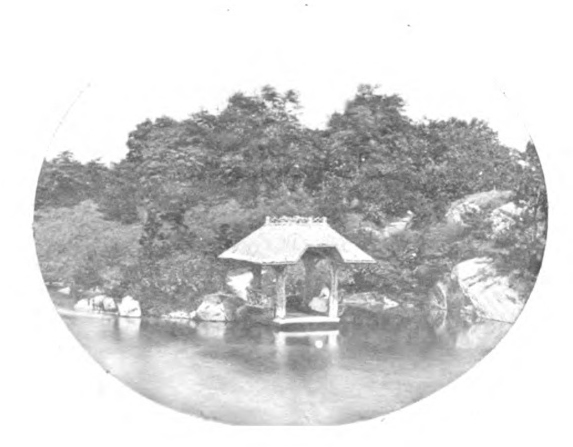
Another photograph from the Board: a boat landing on the Lake.
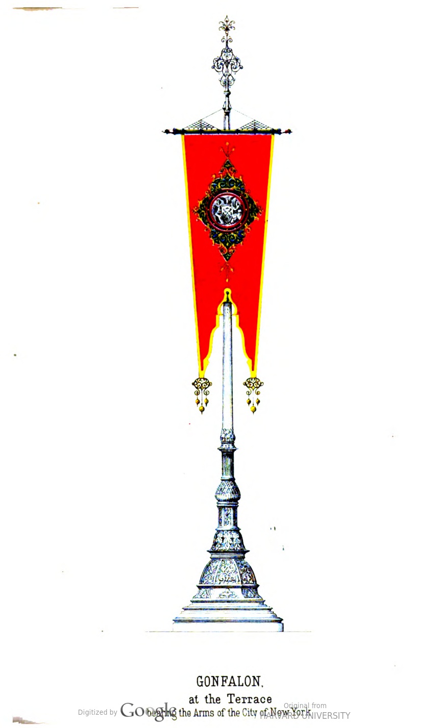
One of the pair of gonfalons at Bethesda Terrace. The image doesn’t give an attribution, but it must be Jacob Wrey Mould’s work.
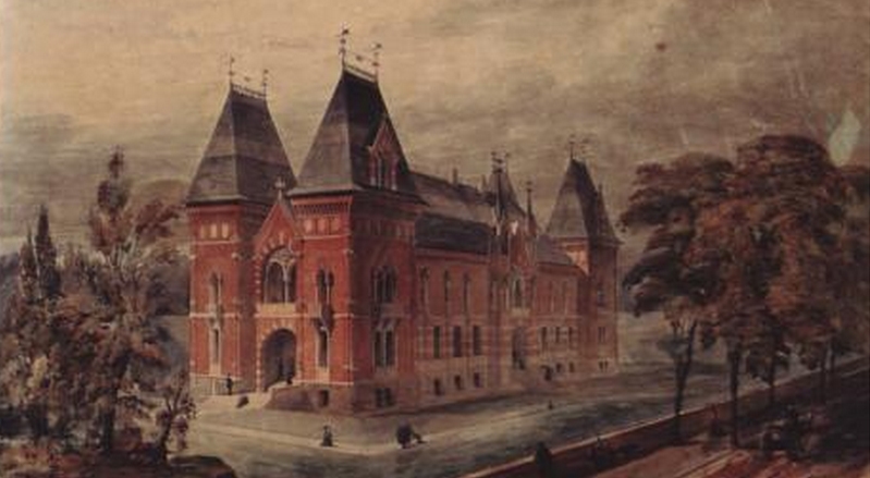
Famed architect Richard Morris Hunt’s plan for updating the Arsenal into a home for the New-York Historical Society.
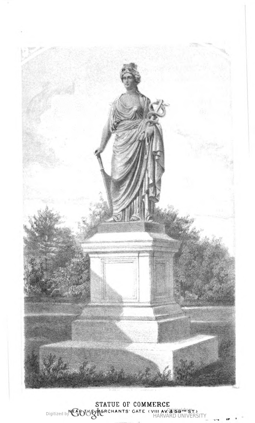
One of the lost sculptures of Central Park: Commerce, originally placed near the Merchants’ Gate at the intersection of Broadway, Central Park West, and 59th Street.
More
- This page is a work in progress: bookmark it, or follow me on Twitter @NYCsculpture to be notified when new images are added.
- Central Park: The Early Years covers Central Park from the 1850s to 1870s. Details here, or order on Amazon here.
- Want wonderful art delivered weekly to your inbox? Check out my free Sunday Recommendations list and rewards for recurring support: details here.